The deadly volcanic eruption of Anak Krakatoa in 2018 unleashed a wave at least 100m high that could have caused widespread devastation had it been travelling in another direction, new research shows.
Over 400 people lost their lives in December 2018 when Anak Krakatoa erupted and partially collapsed into the sea, sending a wave westward towards the Indonesian island of Sumatra that was between 5 and 13 metres high when it made landfall less than an hour later.
However, new analysis from researchers at Brunel University London and the University of Tokyo has shown that the disaster wreaked could have been significantly worse had the wave – which started between 100m and 150m high – been travelling towards closer shores.
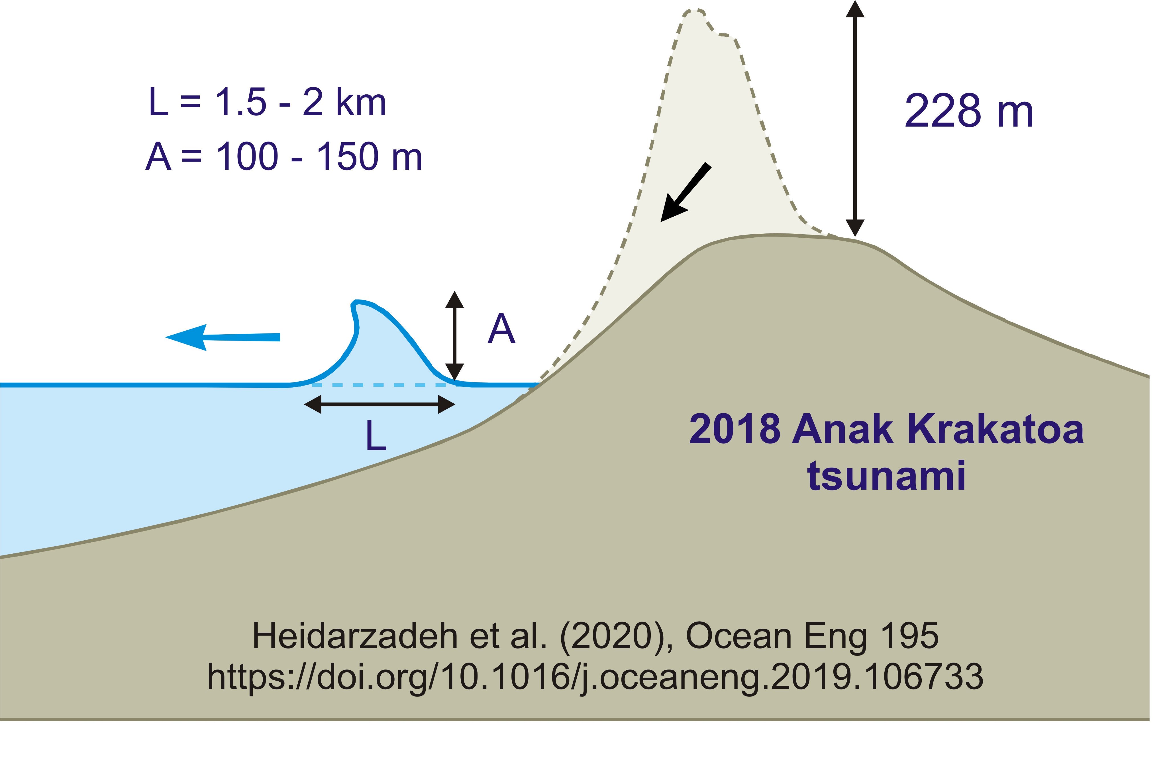
"When volcanic materials fall into the sea they cause displacement of the water surface,” said Dr Mohammad Heidarzadeh, an assistant professor of civil engineering at Brunel, who led the study. “Similar to throwing a stone into a bathtub – it causes waves and displaces the water.
“In the case of Anak Krakatoa, the height of the water displacement caused by the volcano materials was over 100m.”
Although the height of the wave quickly shrunk, thanks mainly to the joint effects of gravity pulling the mass of water downward and the friction generated between the tsunami wave and the seafloor, it was still over 80m high when it hit an uninhabited island just a few kilometres away.
“Fortunately, nobody was living on that island,” said Dr Heidarzadeh. “However, if there was a coastal community close to the volcano – say, within 5km – the tsunami height would have been between 50m and 70m when it hit the coast.”
For context, Dr Heidarzadeh gives the example of the 1883 eruption of Krakatoa, which generated a tsunami that struck land at a maximum height of 42m, causing at least 36,000 deaths at a time when the coastal areas were less populated.
The movement of the tsunami wave following the volcano's collapse
The new research is important for coastal communities living near volcanos all over the world, said Dr Heidarzadeh, as it’s the first to show that such a huge wave could be generated by the December 2018 Anak Krakatoa volcanic eruption.
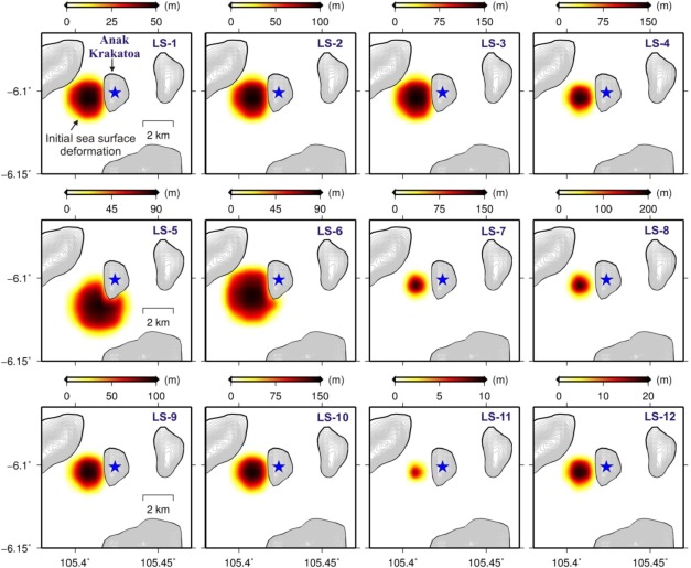
The new analysis, published in the journal Ocean Engineering, used sea-level data from five locations near Anak Krakatoa to validate computer models which simulated the tsunami’s movement from the collapse of the volcano to landfall.
“The measurements were done by wave gauges operated by the government of Indonesia,” Dr Heidarzadeh said.
“We used that real data to make sure that our simulations are consistent with reality – it’s extremely important to validate computer simulations with real-world data.”
Indonesia, one of the most earthquake and tsunami prone areas of the world, was struck by two deadly waves in 2018 – one unleashed by Anak Krakatoa, and one by a landslide off the coast of Sulawesi, which killed over 2000 people.
Dr Heidarzadeh will now be working with the Indonesian Institute of Sciences (LIPI) and Agency for the Assessment & Application of Technology (BPPT) to map the country’s eastern seafloor and develop a new tsunami resilience plan – a project funded by £500,000 from The Royal Society.
Reported by:
Tim Pilgrim,
Media Relations
+44 (0)1895 268965
tim.pilgrim@brunel.ac.uk